News from Google
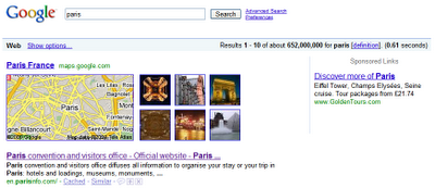
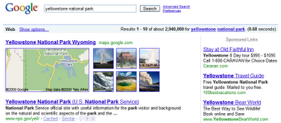
As an avid traveler, I know how helpful it can be to see a map when searching for a location on Google. Using our Universal Search technology, we have provided maps in our search results for more than two years. However, as any traveler could tell you, knowing the geographical location of a place is only part of the story. It's often just as valuable to get a sense of what the place is like, and there's no better way to do that than by looking at images of some of its most important sights.Now, when you search for locations using Google Search, you may see pictures from that place alongside a map. You can click on any of those images to go to the photos layer on Google Maps where you can browse many more geo-tagged photos.
So if you searched for [Paris], you'd see:

Here's [Yellowstone National Park]:

We think this is a great way to get a better sense of a location as well as get a taste of some of the great user-contributed photos that await on Google Maps. We hope you'll have a fun time exploring!
Lingyun Liu, Software Engineer
googleblog.blogspot.com
published @ July 11, 2009

